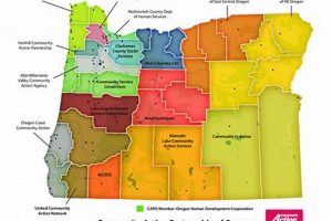
A geographical representation indicating areas with varying levels of flood risk within the state of Oregon. These maps, typically created by agencies like FEMA (Federal Emergency Management Agency), delineate Special Flood Hazard Areas (SFHAs) and other zones reflecting different probabilities of flooding. They serve as a critical resource for understanding potential flood hazards across the state.
These resources are essential for community planning, emergency management, and insurance requirements. They inform decisions regarding development, infrastructure projects, and property purchases, helping to mitigate potential flood damage. Historically, inaccurate or absent delineations have led to significant property damage and loss of life, underscoring the necessity of accurate and updated representations.
The following sections will delve into the specifics of how these maps are created and used in Oregon, focusing on access methods, interpretation challenges, and the implications for landowners and community stakeholders.
Effective utilization of flood risk mapping requires a strategic approach. These tips outline essential factors for understanding and leveraging these resources for informed decision-making.
Tip 1: Consult Official Sources: Always refer to official sources, such as FEMAs Map Service Center or Oregon’s state mapping resources. Third-party websites may not reflect the most current or accurate data.
Tip 2: Understand Flood Zone Designations: Familiarize yourself with the various flood zone designations (e.g., Zone A, Zone AE, Zone X). Each designation carries specific implications for insurance requirements and building regulations.
Tip 3: Review Base Flood Elevations (BFEs): Pay close attention to BFEs, which indicate the anticipated height of floodwater during a base flood. This information is crucial for determining appropriate elevation levels for new construction or property improvements.
Tip 4: Consider Future Conditions: While the mapping reflects current data, consider projections for future conditions, including climate change impacts and potential shifts in flood patterns. These factors can influence long-term risk assessments.
Tip 5: Explore Local Regulations: Engage with local planning departments to understand specific floodplain management regulations applicable within your jurisdiction. Local ordinances may impose stricter requirements than federal guidelines.
Tip 6: Investigate Historical Flood Data: Research historical flood events in your area to gain a better understanding of past flood patterns and potential vulnerabilities not explicitly represented on the mapping.
Tip 7: Engage with Professionals: Consult with qualified professionals, such as surveyors, engineers, and insurance agents, to obtain expert guidance on interpreting the mapping and mitigating flood risks.
By adhering to these considerations, stakeholders can make informed decisions regarding property development, risk mitigation, and insurance coverage. A comprehensive understanding of these resources is crucial for protecting property and ensuring community resilience.
The subsequent sections will explore the specific applications of this data in Oregon, including its impact on property values, insurance rates, and community development strategies.
1. Flood Risk Delineation
Flood Risk Delineation, a core function of a flood zone map in Oregon, involves the systematic identification and categorization of geographic areas based on their susceptibility to flooding. This process is fundamental to understanding potential hazards and implementing appropriate mitigation strategies.
- Hydrologic and Hydraulic Modeling
Flood risk delineation heavily relies on hydrologic and hydraulic modeling to simulate flood events. These models use historical data, topographical information, and projected climate change scenarios to predict the extent and depth of flooding. For example, the Willamette River Basin flood studies use these models to map areas likely to flood during a 100-year flood event, directly informing the boundaries of flood zones depicted on the map.
- Topographic Data Integration
Accurate topographic data, often obtained through LiDAR (Light Detection and Ranging) surveys, is crucial for delineating floodplains. This data provides detailed elevation information, enabling the precise mapping of areas that could be inundated. Coastal areas of Oregon, subject to sea-level rise, require frequent updates to topographic data to accurately reflect changing flood risks, influencing zone boundaries.
- Flood Frequency Analysis
Flood frequency analysis is a statistical method used to estimate the probability of floods of different magnitudes occurring in a given area. This analysis helps determine the Base Flood Elevation (BFE), which serves as a critical benchmark for construction and insurance purposes within identified flood zones. For instance, areas along the Columbia River use flood frequency analysis to define BFEs, impacting building codes and insurance rates.
- Spatial Data Representation
The output of flood risk delineation is typically represented as spatial data layers within a Geographic Information System (GIS). This allows for the visualization and analysis of flood risks in conjunction with other relevant data, such as property boundaries and infrastructure locations. Oregon’s Department of Geology and Mineral Industries (DOGAMI) uses GIS to create and maintain its state-wide flood zone maps, providing accessible information to the public and government agencies.
These elements collectively contribute to creating a comprehensive and accurate representation of flood risks within Oregon. Understanding these components is essential for stakeholders to effectively use and interpret the maps for informed decision-making and risk mitigation. Continual refinement and updating of the underlying data and methodologies are crucial to ensuring the maps remain relevant and reliable in the face of evolving environmental conditions.
2. Insurance Rate Determination
Insurance rate determination, inextricably linked to flood zone maps in Oregon, is a process whereby insurance providers assess the potential risk of flooding to properties and subsequently calculate premiums. The accuracy and granularity of the map directly influence the perceived risk and, consequently, the cost of flood insurance.
- Flood Zone Classification and Base Rates
The primary determinant of flood insurance rates is the flood zone classification assigned to a property. Properties located within Special Flood Hazard Areas (SFHAs), designated as Zones A or V on the map, are considered to have a higher risk and are subject to mandatory flood insurance if they have a federally backed mortgage. Base rates, established by FEMA and participating insurers, are directly tied to these zone classifications. For instance, a property in Zone AE, indicating a 1% annual chance of flooding, will typically incur significantly higher premiums than a property in Zone X, considered a minimal risk zone.
- Base Flood Elevation (BFE) and Relative Elevation
Insurance rates are further refined based on the property’s elevation relative to the Base Flood Elevation (BFE). Properties built below the BFE are at greater risk of inundation and, therefore, face higher premiums. Conversely, structures elevated above the BFE may qualify for reduced rates. For example, if a building is two feet below the BFE according to the map data, the insurance premium will be higher compared to a similar building constructed one foot above the BFE.
- Coverage Amount and Deductible Selection
The amount of flood insurance coverage purchased directly affects the premium. Homeowners can choose coverage limits up to a certain maximum, often tied to the property’s replacement cost. Selecting a higher deductible reduces the premium but increases the out-of-pocket expenses in the event of a flood. A home in a high-risk zone may require a $250,000 policy, and the premium would vary considerably depending on whether the homeowner selects a $1,000 or $5,000 deductible.
- Community Rating System (CRS) Credits
Communities participating in FEMA’s Community Rating System (CRS) can earn credits for implementing floodplain management activities that exceed minimum standards. These credits translate into reduced flood insurance premiums for property owners within the community. A community that proactively manages its floodplain and earns a high CRS rating, such as implementing stricter building codes or preserving natural floodplains, can offer its residents significant discounts on flood insurance.
The interplay between flood zone maps and insurance rate determination underscores the importance of accurate and up-to-date mapping data. Discrepancies or errors in the map can lead to incorrect rate assessments, potentially resulting in underinsurance or unfairly high premiums. This system highlights the critical role that detailed and reliable flood maps play in ensuring fair and equitable flood insurance pricing across Oregon.
3. Development Regulation Compliance
Development Regulation Compliance, within the context of Oregon’s flood zone map, dictates the permissible types and methods of construction and land use activities in areas susceptible to flooding. These regulations aim to minimize flood damage, protect public safety, and ensure responsible land management.
- Building Code Adherence
Construction within designated flood zones necessitates strict adherence to specific building codes outlined in the Oregon Building Codes. These codes often mandate elevation requirements, flood-resistant materials, and anchoring techniques designed to withstand flood forces. For example, new residential construction in a Zone AE might require elevating the lowest floor above the Base Flood Elevation (BFE) and using waterproof materials below that level. Non-compliance can result in denied permits and increased risk of structural failure during a flood event.
- Permitting Processes
Any development project within a mapped floodplain in Oregon requires a permit from the local jurisdiction, often reviewed by the state’s Department of Land Conservation and Development (DLCD). The permitting process ensures that proposed projects meet the required floodplain management standards. A permit might be denied if a proposed structure obstructs flood flows, increases flood heights on neighboring properties, or does not meet elevation requirements. Stringent permitting is essential to controlling development and mitigating flood risks effectively.
- Floodplain Management Ordinances
Local jurisdictions in Oregon adopt floodplain management ordinances that regulate development activities within flood zones. These ordinances may impose stricter standards than federal or state regulations, reflecting local conditions and priorities. For instance, a city might establish stricter freeboard requirements (requiring structures to be elevated higher than the BFE) or limit certain types of development within vulnerable areas. Consistent enforcement of these ordinances is crucial for minimizing future flood losses.
- Substantial Improvement and Damage Rules
Federal regulations, adopted and enforced in Oregon, govern what constitutes a “substantial improvement” or “substantial damage” to existing structures within flood zones. If the cost of improvements or repairs to a structure exceeds 50% of its market value, the structure must be brought into compliance with current floodplain management standards. This rule aims to prevent repetitive flood losses and encourage relocation or mitigation measures for vulnerable properties. For example, if a flood-damaged home in Zone AE requires repairs exceeding 50% of its pre-flood value, the homeowner must elevate the house to meet current BFE requirements during reconstruction.
These facets of Development Regulation Compliance work in concert, directly informed by the details provided in Oregon’s flood zone map. The regulations, permitting processes, and building codes ensure that development is conducted responsibly, balancing economic growth with the imperative to protect communities from the inherent risks associated with flooding. Effective enforcement and continued monitoring of these regulations are essential for maintaining long-term community resilience.
4. Community Resilience Planning
Community resilience planning involves proactive strategies to prepare for, respond to, and recover from disruptive events, including flooding. In Oregon, the flood zone map serves as a foundational element for this planning, providing critical information about areas at risk and informing mitigation efforts.
- Infrastructure Protection and Investment
Resilience planning utilizes flood zone maps to identify critical infrastructure, such as hospitals, schools, and emergency services, located within flood-prone areas. This identification informs decisions regarding infrastructure upgrades, relocation, or the implementation of floodproofing measures. For example, a hospital situated in a mapped floodplain might invest in flood barriers and backup power systems to ensure continued operation during a flood event. Prioritizing infrastructure protection enhances the community’s ability to respond to and recover from flooding.
- Land Use and Zoning Regulations
Flood zone maps guide land use and zoning regulations, restricting or modifying development in high-risk areas. These regulations might limit the density of development, require elevated construction, or promote open space preservation to reduce flood impacts. In coastal communities in Oregon, zoning regulations informed by these maps can restrict building in vulnerable areas subject to sea-level rise and storm surge. Strategic land use planning minimizes future flood damage and promotes sustainable development.
- Emergency Response and Evacuation Planning
The maps inform emergency response and evacuation plans, delineating areas likely to be inundated and guiding the development of evacuation routes and shelter locations. Effective evacuation plans rely on accurate mapping data to ensure timely and safe evacuation of residents from flood-prone areas. For example, cities use the maps to create evacuation zones and communication strategies for residents in areas along the Willamette River, facilitating a coordinated response during flood events.
- Public Awareness and Education Campaigns
Flood zone maps are used in public awareness and education campaigns to inform residents about flood risks and preparedness measures. These campaigns aim to increase awareness of flood hazards, promote flood insurance coverage, and encourage individual mitigation actions. Oregon’s state agencies use flood zone maps in public outreach materials to educate residents about their flood risk and provide guidance on how to protect their property and families. Empowering citizens with knowledge promotes a culture of preparedness and resilience within the community.
The connection between community resilience planning and the flood zone map underscores the importance of accurate and accessible flood risk information. By integrating map data into comprehensive planning efforts, communities in Oregon can enhance their ability to withstand and recover from flood events, protecting lives, property, and the environment.
5. Data Accuracy & Updates
The reliability of Oregon’s flood zone maps hinges critically on the accuracy of the underlying data and the frequency with which these maps are updated. Inaccurate or outdated mapping can lead to misinformed decisions, inadequate mitigation measures, and increased vulnerability to flood damage, thereby underscoring the vital connection between these elements.
- LiDAR and Topographic Surveys
High-resolution topographic data, frequently acquired through LiDAR surveys, forms the foundation of accurate flood zone mapping. Regular surveys are necessary to account for natural changes in terrain, erosion, and the impacts of development. For example, coastal erosion can significantly alter floodplains, necessitating updated LiDAR data to accurately reflect current risks. Neglecting to update this data can result in an underestimation of flood hazards.
- Hydrologic and Hydraulic Modeling Revisions
Hydrologic and hydraulic models are essential for simulating flood events and delineating floodplains. These models must be regularly revised to incorporate new data, improved modeling techniques, and the effects of climate change. For instance, projections of increased precipitation and sea-level rise require updates to these models to accurately reflect future flood risks. Failure to incorporate these changes can lead to inaccurate mapping and inadequate preparedness.
- Incorporation of Post-Flood Event Data
Following significant flood events, collecting and integrating post-flood data, such as flood extent and depth measurements, is crucial for validating and refining flood zone maps. This data helps identify areas where existing mapping may be inaccurate or incomplete. For example, if a flood inundates areas not previously identified as flood zones, map revisions are necessary to reflect this new information and inform future development decisions.
- Community Input and Verification Processes
A robust map update process includes opportunities for community input and verification. Local knowledge and observations can identify discrepancies between the map and real-world conditions. Formal appeals processes allow stakeholders to challenge the accuracy of flood zone designations. Engaging the community ensures that local expertise is incorporated into the mapping process, improving accuracy and fostering trust in the maps’ reliability.
The accuracy and currency of Oregon’s flood zone maps directly impact their effectiveness in informing land use planning, building codes, insurance rates, and emergency management. A commitment to ongoing data collection, model refinement, and community engagement is essential for maintaining the integrity of these maps and ensuring that they accurately reflect the ever-changing flood risks across the state.
Frequently Asked Questions
This section addresses common inquiries regarding flood zone maps in Oregon, providing clarification on their purpose, interpretation, and implications.
Question 1: What exactly is a flood zone map?
A flood zone map is a geographical representation delineating areas with varying degrees of flood risk. Typically produced by FEMA or state agencies, it indicates Special Flood Hazard Areas (SFHAs) and other zones based on the probability of flooding.
Question 2: How does one access flood zone information for a specific property in Oregon?
Flood zone data can be accessed through the FEMA Map Service Center website or the Oregon Department of Geology and Mineral Industries (DOGAMI) website. These resources allow searching by address or geographic location to determine the flood zone designation.
Question 3: What are the implications of a property being located within a Special Flood Hazard Area (SFHA)?
Location within an SFHA typically mandates flood insurance for properties with federally backed mortgages. It also triggers specific building code requirements to minimize flood damage during construction or renovation.
Question 4: How frequently are flood zone maps updated in Oregon?
The frequency of map updates varies depending on factors such as new development, changes in environmental conditions, and funding availability. FEMA and DOGAMI periodically revise and update the maps based on new data and modeling.
Question 5: What is a Base Flood Elevation (BFE), and how is it used?
The Base Flood Elevation (BFE) represents the anticipated water surface elevation during a base flood, which has a 1% annual chance of occurrence. It serves as a reference point for determining building elevation requirements and flood insurance rates.
Question 6: Can a flood zone designation be challenged or appealed?
Property owners have the right to challenge or appeal a flood zone designation if they believe it is inaccurate. The appeal process typically involves submitting technical data to FEMA or the local jurisdiction to support the claim.
Understanding these core questions surrounding Oregon’s flood zone mapping framework provides a solid foundation for navigating flood risk assessment and management.
The following sections will transition to actionable steps that landowners and community stakeholders can take to further protect their properties and interests.
Conclusion
The preceding analysis has demonstrated that the “flood zone map Oregon” is more than a cartographic representation; it is a critical instrument influencing development standards, insurance costs, and community resilience. Its accuracy and consistent application are paramount to mitigating potential flood damage across the state.
Continued vigilance regarding data updates, adherence to regulatory compliance, and proactive community engagement remain essential. The long-term effectiveness of flood mitigation strategies in Oregon hinges on a comprehensive understanding and responsible utilization of the information provided by the “flood zone map Oregon.”


