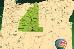
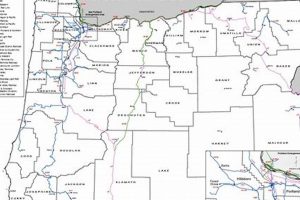
A visual representation indicating locations within Oregon where gold has been found or is likely to be found. This tool can include topographical information, geological surveys, and historical mining data overlaid to pinpoint potential prospecting sites. For instance, such a resource might highlight areas along the Rogue River or in the Blue Mountains known for placer deposits.
The significance of these cartographic resources lies in their ability to streamline the search for precious metals. By consolidating diverse data sources into a single, easily interpretable format, they offer a practical advantage to prospectors and hobbyists. Historically, these maps have played a pivotal role in guiding mining activities, contributing to the economic development of specific regions within the state.
The following discussion will delve into the types of information these visual aids contain, how to effectively utilize them, and the legal considerations pertaining to prospecting and mining in the state.
Effective utilization of resources indicating the location of precious metals requires careful consideration of several factors. The following guidelines are designed to enhance the prospector’s success and ensure responsible engagement with the environment.
Tip 1: Cross-Reference Multiple Sources: Avoid reliance on a single data source. Compare different resources to identify areas where information converges, suggesting a higher probability of gold occurrence. For example, correlate historical mining records with geological survey maps.
Tip 2: Understand Geological Indicators: Familiarize yourself with geological formations conducive to gold deposition. Alluvial fans, ancient riverbeds, and areas with exposed bedrock are prime candidates for exploration. Identify these features to refine search parameters.
Tip 3: Research Historical Mining Activity: Investigate historical mining operations in the area of interest. Old mining sites, while potentially depleted, may still contain residual gold or provide insights into the local geology and gold distribution patterns. Examine records from the Oregon Department of Geology and Mineral Industries.
Tip 4: Prioritize Areas with Placer Deposits: Placer deposits, formed by the erosion and concentration of gold in stream beds, are often easier to access and process than hard rock deposits. Focus initial efforts on regions known for placer mining, such as the southwestern part of the state.
Tip 5: Respect Private Property Rights: Confirm land ownership before commencing any prospecting activities. Trespassing on private land is illegal and can result in legal penalties. Utilize county assessor records to determine ownership boundaries.
Tip 6: Comply with Environmental Regulations: Adhere to all state and federal environmental regulations pertaining to mining and prospecting. Obtain necessary permits and employ responsible mining practices to minimize environmental impact. Contact the Oregon Department of Environmental Quality for guidance.
Tip 7: Utilize GPS Technology: Employ GPS devices to precisely locate and mark potential prospecting sites. This facilitates accurate navigation and documentation, enabling efficient resource management and return visits.
By adhering to these guidelines, prospectors can increase their chances of success while minimizing environmental impact and ensuring compliance with legal requirements. The careful application of this knowledge enhances the potential for discovery and promotes responsible resource extraction.
The subsequent sections will explore the legal framework governing gold prospecting and mining in Oregon, providing a comprehensive understanding of the regulatory landscape.
1. Historical Finds
Historical finds are a critical component in interpreting and utilizing visual resources indicating locations of precious metals in Oregon. The documented presence of past mining activities provides invaluable context for current prospecting efforts, offering insights into potential gold-bearing regions and geological formations.
- Legacy Mining Districts
Mapping historical mining districts overlays a layer of proven gold production onto current maps. Areas like the Bohemia Mining District, with extensive documented yields, become high-priority zones for further investigation. The documented success of past operations indicates favorable geological conditions and potential for undiscovered deposits.
- Historical Production Records
Production records, often maintained by county or state historical societies, quantify gold extraction from specific areas. These records can be integrated into resources to show the concentration and volume of gold recovered in the past. Locations with substantial historical production often warrant renewed exploration due to the possibility of overlooked or deeper deposits.
- Abandoned Mines and Tailings
Locations of abandoned mines and tailings piles are significant indicators. Resources identifying these sites suggest areas where gold extraction occurred, but processing techniques may have been less efficient, leaving residual gold in the tailings. These sites may present opportunities for reprocessing using modern methods.
- Early Prospecting Routes
Mapping early prospecting routes provides clues to the distribution of gold deposits. The routes followed by early miners often followed gold-bearing streams and rivers. These routes, when overlaid on current resources, help to identify areas that were historically significant and may still hold potential.
Integrating historical finds into cartographic resources enhances the effectiveness of modern prospecting efforts. By understanding the context of past mining activities, prospectors can refine their search parameters, prioritize areas with proven gold production, and potentially uncover new deposits in historically significant regions.
2. Geological Surveys
Geological surveys are foundational to the creation and interpretation of resources indicating locations of precious metals in Oregon. These surveys provide critical data on the state’s geological composition, structure, and history, which are essential for predicting and locating gold deposits.
- Bedrock Mapping
Bedrock mapping identifies and classifies the types of rocks that underlie a given area. Gold is often associated with specific types of bedrock, such as volcanic rocks or metamorphic formations. By mapping bedrock, geological surveys delineate regions where gold mineralization is more likely to occur. An example is the mapping of the Klamath Mountains, known for their gold-bearing ultramafic rocks. The presence of specific bedrock types directly informs the potential for gold discoveries.
- Fault and Fracture Analysis
Faults and fractures in the earth’s crust can act as pathways for mineral-rich fluids. Gold deposits often form along these structural features as the fluids cool and precipitate minerals. Geological surveys analyze fault and fracture patterns to identify areas where gold mineralization may have occurred. Studies of the Blue Mountains region have shown a correlation between fault zones and gold occurrences. The density and orientation of faults significantly impact the distribution of gold deposits.
- Geochemical Sampling
Geochemical sampling involves collecting and analyzing soil, rock, and stream sediment samples for the presence of gold and associated indicator elements. Elevated concentrations of gold or other metals like arsenic or silver can suggest the presence of nearby gold deposits. Stream sediment surveys in the Rogue River basin have been used to identify areas with anomalous gold concentrations. The results of geochemical sampling provide direct evidence of gold mineralization.
- Remote Sensing Techniques
Remote sensing techniques, such as satellite imagery and aerial surveys, provide broad-scale information about geological features and mineral alterations. These techniques can identify areas with altered rock surfaces, which may be associated with gold mineralization. For example, Landsat imagery has been used to map alteration zones in the Owyhee region, indicating potential areas for gold exploration. Remote sensing provides a cost-effective method for identifying large-scale geological features associated with gold deposits.
The insights derived from geological surveys are integral to the development and refinement of resources indicating locations of precious metals. By understanding the geological context, prospectors can more effectively target their exploration efforts and increase their chances of success. These surveys provide the scientific basis for informed decision-making in gold exploration and mining.
3. Accessibility (Land Status)
Land status is a paramount consideration when utilizing resources indicating locations of precious metals in Oregon. The legal framework governing land ownership and mineral rights directly dictates where prospecting and mining activities are permissible. Understanding these regulations is critical for avoiding legal conflicts and ensuring compliance.
- Public vs. Private Land Demarcation
Visual resources typically delineate public and private lands, which have significantly different regulations regarding mineral exploration. Public lands, managed by agencies like the Bureau of Land Management (BLM) and the United States Forest Service (USFS), often allow recreational prospecting subject to certain rules and restrictions. Private lands, conversely, require explicit permission from the landowner before any prospecting activities can commence. Resources incorporating land status information enable prospectors to quickly identify permissible areas for exploration.
- Mining Claim Locations
Areas already under mining claim are generally off-limits to prospecting without the claim holder’s consent. Resources often display the locations of active mining claims, helping prospectors avoid infringing on existing mineral rights. For example, resources might show the boundaries of claims registered with the BLM, preventing unintentional trespass and potential legal disputes. The ability to visualize claim locations is essential for responsible prospecting.
- Withdrawals and Restrictions
Certain areas may be withdrawn from mineral entry due to environmental concerns, historical significance, or other reasons. These withdrawals restrict or prohibit mineral exploration and development. Resources may indicate the locations of these withdrawn areas, preventing prospectors from wasting time and resources on land where mining is prohibited. Examples include areas designated as wilderness areas or national monuments, where mining activities are typically restricted.
- Navigational Easements and Access
Even on public lands open to mineral entry, accessibility can be limited by navigational easements or physical barriers. Resources may display information about road access, trail networks, and stream crossings, providing practical guidance for reaching potential prospecting sites. Additionally, some areas may require permits for vehicle access or motorized equipment. Understanding these access constraints is vital for planning prospecting expeditions.
The integration of land status information into resources indicating locations of precious metals is crucial for responsible and legally compliant prospecting in Oregon. By understanding the complex web of land ownership, mining claims, withdrawals, and access restrictions, prospectors can maximize their chances of success while minimizing the risk of legal and environmental repercussions. Land status awareness is a fundamental element of ethical prospecting practices.
4. Placer Locations
Placer locations represent a significant focus within resources indicating the presence of precious metals in Oregon. These deposits, formed by the concentration of gold through natural processes, often offer accessible opportunities for prospectors. Their identification and mapping are critical for efficient and productive gold exploration.
- Alluvial Fan Deposits
Alluvial fans, formed by sediment deposition at the base of mountains or hills, can concentrate gold particles due to the sorting action of flowing water. Resources often highlight areas where historical or current alluvial fans exist. For example, the western slopes of the Cascade Range exhibit several alluvial fans known to contain placer gold. Identifying these geological formations within a resource allows prospectors to focus their efforts on areas with naturally concentrated gold.
- Terrace Gravels
Terrace gravels represent ancient riverbeds elevated above the current floodplain. These gravels often contain significant placer gold deposits that have been preserved over time. Resources might indicate the presence of terrace gravels along major rivers such as the Rogue or the John Day. The elevated nature of these deposits can make them more accessible than active riverbeds, offering potentially lucrative prospecting sites.
- Beach Placers
Along the Oregon coast, beach placers can form due to wave action concentrating gold particles from offshore sources or eroding coastal cliffs. Resources might depict areas with known beach placer deposits, such as those found near Gold Beach. These locations offer a unique prospecting environment, but are also subject to coastal erosion and tidal influences, requiring specialized knowledge and techniques.
- Streambed Concentrations
Active streambeds remain primary targets for placer gold exploration. Resources often highlight specific sections of streams and rivers where gold is known to accumulate due to geological features like bedrock riffles or bends in the channel. The presence of black sands, which are heavy mineral concentrates often found alongside gold, can also be indicated. These streambed concentrations represent dynamic environments where gold is constantly being deposited and redistributed.
The mapping of placer locations within resources significantly enhances the efficiency of gold prospecting in Oregon. By identifying and focusing on areas where gold has been naturally concentrated, prospectors can increase their chances of success and minimize the time and resources expended in unproductive areas. These resources provide a valuable tool for both experienced and novice gold seekers.
5. Claim Boundaries
The delineation of claim boundaries is fundamental to responsible and legally compliant gold prospecting in Oregon. Resources, particularly those visually representing potential gold locations, incorporate claim boundaries to demarcate areas where mineral rights are already held by individuals or entities. Failure to acknowledge and respect these boundaries can lead to legal repercussions, including fines and potential litigation.
The cause-and-effect relationship between claim boundaries and prospecting activities is direct: prospecting within a valid claim without permission from the claim holder constitutes trespassing and infringement on mineral rights. For example, if a resource indicates that a specific area along the John Day River is under claim by “XYZ Mining,” any gold recovered from that area by an unauthorized individual would legally belong to “XYZ Mining,” potentially resulting in legal action against the unauthorized prospector. This underscores the importance of accurately interpreting claim boundary data on prospecting resources.
These resources typically obtain claim boundary information from official sources, such as the Bureau of Land Management (BLM) records, which maintain a database of active mining claims. However, claim boundaries can change over time due to claim transfers, abandonment, or invalidation. Therefore, it is crucial to consult the most up-to-date official records in conjunction with any visual aids. Understanding and respecting claim boundaries is not only a legal obligation but also an ethical one, contributing to the responsible and sustainable use of Oregon’s mineral resources.
6. Topographical Details
Topographical details are integral to resources indicating locations of precious metals in Oregon, as they directly influence gold deposition and accessibility. The terrain’s elevation, slope, and surface features dictate water flow, erosion patterns, and sediment transport, which are primary factors in the formation of placer deposits. Visualizations of these features enhance the accuracy and utility of gold prospecting tools. For instance, a resource showing steep valley gradients alongside historical mining activity suggests areas where concentrated gold may have accumulated due to high-energy water transport.
The practical significance of understanding topographical details lies in optimizing prospecting strategies. Contour lines on a resource can reveal areas with gentle slopes conducive to placer formation, or steep inclines where bedrock outcrops may contain lode deposits. Shaded relief maps can highlight subtle changes in elevation indicative of ancient river channels now buried beneath sediment. Furthermore, topographical information facilitates logistical planning by indicating road access, stream crossings, and potential hazards, like landslides, thereby enhancing safety and efficiency during field operations.
In summary, topographical details are not merely aesthetic additions but essential data layers within resources indicating locations of gold. They provide critical insights into gold concentration processes, guide prospecting efforts towards favorable terrain, and inform logistical considerations. Challenges remain in accurately representing complex terrain and integrating this data with other geological and historical information. However, the inclusion of topographical details significantly enhances the value and reliability of these prospecting tools.
Frequently Asked Questions
This section addresses common inquiries concerning visual and cartographic resources used to locate gold within the state of Oregon. The information provided aims to clarify their utility, limitations, and responsible usage.
Question 1: What is the primary purpose of a “gold in Oregon” resource?
The primary purpose is to provide a visual representation of areas where gold has been found or is likely to be found, based on geological data, historical records, and other relevant information. It serves as a guide for prospectors seeking potential mining sites.
Question 2: Are these resources a guarantee of finding gold?
No. These resources are intended as guides and indicators, not guarantees. Gold distribution is inherently variable, and the information presented is based on available data, which may be incomplete or subject to interpretation. Prospecting success depends on various factors, including skill, effort, and environmental conditions.
Question 3: How accurate are the claim boundary delineations shown on these resources?
Claim boundary information is typically derived from official records, such as those maintained by the Bureau of Land Management (BLM). However, claim status can change, and resources may not always reflect the most current information. It is crucial to verify claim status with the BLM before commencing any prospecting activities.
Question 4: What types of information are typically included?
Resources often include topographical maps, geological surveys, historical mining district locations, placer deposit areas, and land ownership information. The specific data included varies depending on the source and intended use of the resource.
Question 5: Are there any legal considerations when using these resources?
Yes. Prospectors must comply with all applicable federal, state, and local laws and regulations. This includes obtaining necessary permits, respecting private property rights, and adhering to environmental protection guidelines. Trespassing on private land or mining within valid mining claims without permission is illegal.
Question 6: Where can legitimate “gold in Oregon” resources be found?
Reputable resources can be obtained from government agencies (such as the Oregon Department of Geology and Mineral Industries and the BLM), geological societies, and established prospecting organizations. Exercise caution when using online resources, as the accuracy and reliability of these sources may vary significantly.
In conclusion, resources indicating gold locations are valuable tools, but they should be used responsibly and in conjunction with thorough research and compliance with all applicable laws and regulations. Prospecting success requires diligent effort and a realistic understanding of the complexities involved.
The subsequent section will detail specific Oregon counties known for gold deposits and provide insights into their unique geological characteristics.
Conclusion
The preceding discussion has elucidated the multifaceted nature of resources indicating gold locations within Oregon. These tools, when rigorously and ethically applied, offer significant advantages to prospectors, providing insights into geological formations, historical mining activities, land status, and topographical features. Their effective utilization, however, necessitates a comprehensive understanding of their inherent limitations and the prevailing legal framework.
Potential users are reminded that these aids are not definitive guarantees of success but rather guides requiring careful interpretation and verification. Diligence, respect for private property, adherence to environmental regulations, and a commitment to responsible prospecting practices remain paramount. The responsible use of visual prospecting guides, coupled with sound judgment and informed action, will ultimately determine the outcome of any gold-seeking endeavor within the state.


